
OVERVIEW OF THE AGRICULTURAL INDUSTRY IN INDIA
The service sector is declared to be the most substantial contributor to India’s GDP. Our country reigns the world as the most prominent producer of pulses, milk, rice, wheat, sugarcane, spices, etc. These also add generous value to the economy with their activities in the agrarian sector. The Indian agricultural sector contributes a tremendous 18% to India’s GDP (Gross Domestic Product). It is considered the prime source of livelihood for approximately 58% of the country’s population, mainly for rural areas. Indian agriculture sector, along with forestry and fishing, results in a Gross Added Value of around Rs 18.55 lakh crore (US$265.51 billion) as of 2019. The agricultural sector expands with parallel industries at a growth rate of 2.1% (2019-20).

Regardless of Indian agriculture’s contribution to the GDP, our country is yet to enhance productivity and efficiency in the sector to reach the highest potential. Several dimensions and concerns need to be identified, supported, and equipped with resolutions. Unsuitable methods for monitoring crops, water irrigation, using pesticides, and many other necessary farming activities are currently adopted. Resources are inadequate, not allotted according to weather conditions, or have not been exploited to their maximum potential—a reason why there is often a decline in the Return on Investment (ROI).
These hindrances have granted multiple opportunities for growth and development in the world of technology. The influence of technology in the agricultural sector has been invariably positive since its commencement. As governments and businesses across the country recognized the significance of food security and the consequences of environmental degradation, pollution, and water scarcity, the urgency to overcome certain obstacles arose.
WHY ADOPT AGRICULTURAL DRONES?
Drone technology has gotten most of the recognition in the industry because of its diversity and considered the future for the agrarian community. The military initially used them. However, other sectors quickly embraced unmanned aerial vehicles (UAVs) when they learned about its widespread applications.
How can drones support Indian agriculture? Drones don’t merely enhance overall performance but also encourage farmers to solve other assorted barriers and receive plenty of benefits through precision agriculture. With the market for agricultural drones reaching a whopping $1.3 billion, UAVs (unmanned aerial vehicles) fill the gap of human error and inefficiency by traditional farming methods. The purpose of adopting drone technology is to exclude any guesswork or ambiguity and instead focus on accurate and reliable information.
External factors like weather, soil conditions, and temperature play a critical role in farming. Agriculture drone empowers the farmer to adapt to specific environments and make mindful choices accordingly. The gained data helps regulate crop health, crop treatment, crop scouting, irrigation, and carry out field soil analysis and crop damage assessments. The drone survey helps boost crop yields and minimize time and expenses.
According to experts, the predicted world population will be 9 billion by 2050. Agricultural consumption is also said to increase simultaneously by nearly 70%. Drone technology, equipped with artificial intelligence (AI), machine learning (ML), and remote sensing features, are rising in demand because of its advantages. The central government has acknowledged the importance of unmanned aerial vehicles (UAVs), machine learning, and artificial intelligence with their ‘Digital Sky Platform’ online. Drone startups in India have used this opportunity to accomplish better technological capacities.
HOW DOES DRONE TECHNOLOGY WORK?
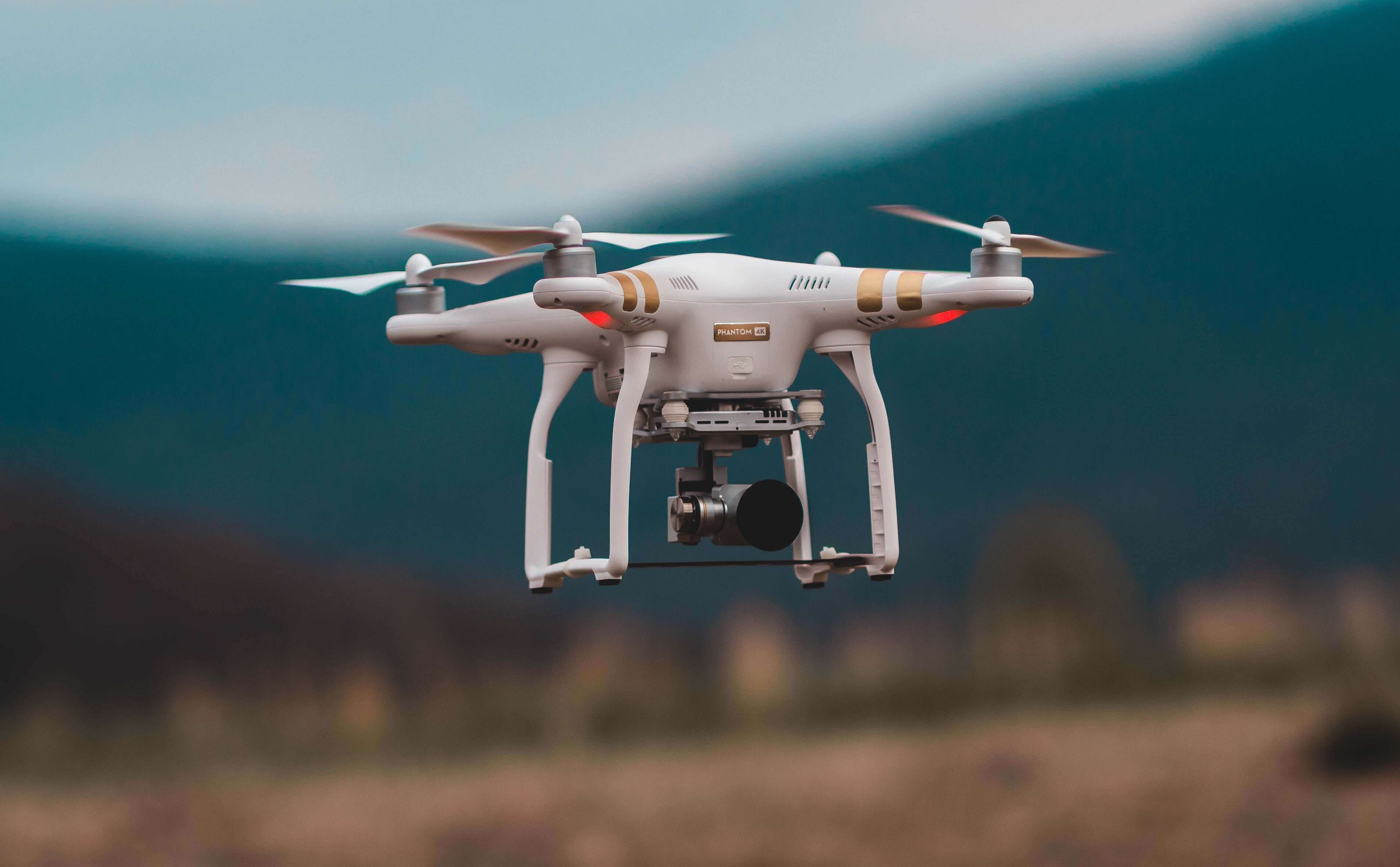
Only after complete recognition of drones characteristics can one gain in-depth knowledge about agriculture drones. Typically, drones include a navigation system, GPS, multiple sensors, high-quality cameras, programmable controllers, and tools for autonomous drones. The DJI is one such familiar drone utilized by the industry. Most farmers currently use satellite imagery as an introductory guide for farm management. Furnished with modern technology, Unmanned aerial vehicles (UAVs) can get more precise data than satellites for precision agriculture. They then process the data captured into agri-tech software to produce beneficial knowledge
Capturing data from agriculture drone takes place as in the following stages
- Analyzing the area: This identifies the territory being tested. Therefore, the first step includes establishing a boundary, analyses of the area, and then finally, uploading the technical GPS information into the drone’s navigation system.
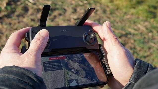
- Using Autonomous Drones: Since Unmanned aerial vehicles (UAVs) are independent, they enter flight patterns into their already established system to collect required data.
- Uploading the data: After capturing all the required data through sensors such as the multispectral sensor/RGB sensor, it is processed through numerous software for further analysis and interpretation.
- Output: After collecting the data, they format it so that farmers can understand the data with no hassle, bringing them a step closer to precision farming. 3D mapping or Photogrammetry are popular methods to display extensive data collected.
You may also like
BEST DRONE PRACTICES
Drone technology quickly reestablishes traditional agrarian practices and is subsequently accomplishing them as follows
- Irrigation Monitoring:
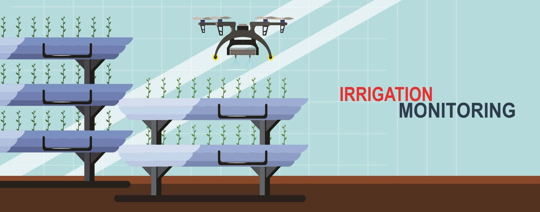
Drones, including hyperspectral, thermal, or multispectral sensors, recognize areas that are too dry or need improvement by the farmer. Drone survey helps improve water efficiency and disclose potential pooling/leaks in irrigation by providing Irrigation monitoring yields calculations of the vegetation index to help realize the health of crops and emitted heat/energy.
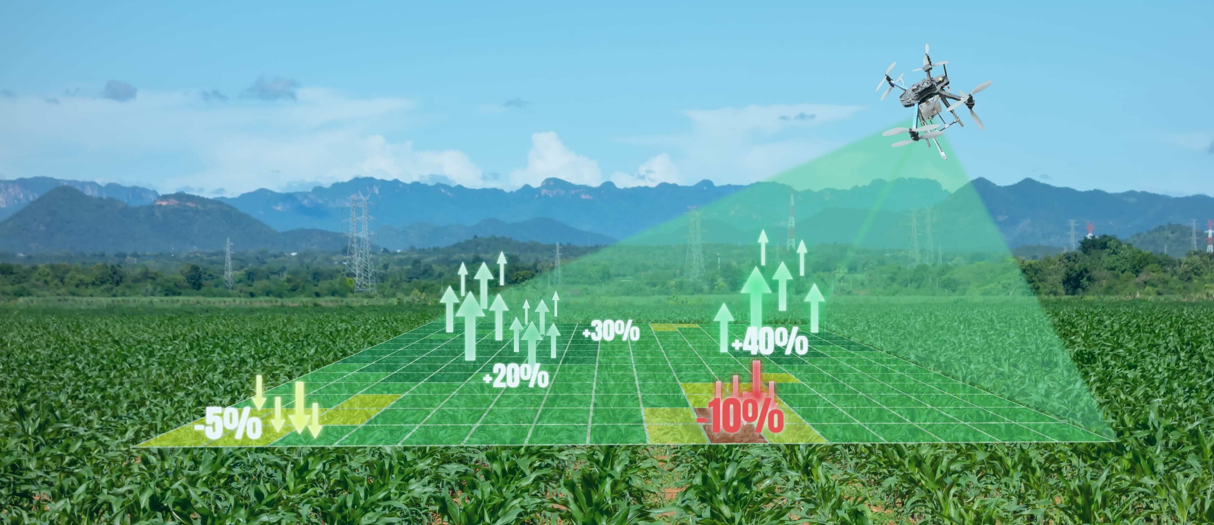
- Crop Health Monitoring and Surveillance
It is crucial to track the health of the vegetation and spot bacterial/fungal plagues in the early stages. Agriculture drones can see which plants reflect different amounts of green light and Near-infrared spectroscopy (NIRS) light. This data helps produce multispectral images to track crop health. Quick monitoring and discoveries of any defects can help save crops. In circumstances of crop failure, the farmer can also document the damages for accurate insurance claims.
- Crop Damage Assessment
Agricultural drones fitted along with multispectral sensors and RGB sensors also detect field areas inflicted by weeds, infections, and pests. According to this data, the exact amounts of chemicals needed to fight these infestations are known, and this helps diminish the costs inflicted by the farmer.
- Field Soil Analysis
The drone survey allows farmers to obtain information about their land’s soil conditions. Multispectral sensors allow seizing data useful for seed planting patterns, thorough field soil analysis, irrigation, and nitrogen-level management. Precise Photogrammetry/ 3D mapping permits farmers to analyze their soil conditions thoroughly.
- Planting
Drone startups in India have invented drone-planting systems that allow drones to shoot pods, their seeds, and crucial nutrients into the soil. This technology doesn’t only reduce costs by almost 85% but also increases consistency and efficiency.
- Agricultural spraying
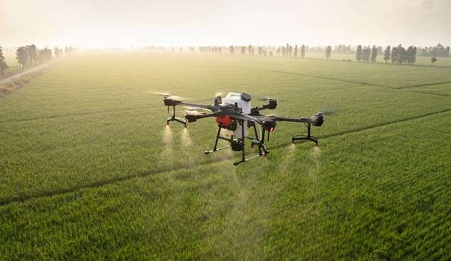
Through drone crop spraying, human contact with such harmful chemicals is limited. Agri-drones can carry out this task much quicker than vehicles/airplanes. Drones with RGB sensors and multispectral sensors can precisely identify and treat problematic areas. Professionals say that aerial spraying is five times faster with drones when compared to other methods.
- Livestock tracking
The drone survey allows the farmers not to keep track of their crops only but also monitor the movements of their cattle. Thermal sensor technology helps find lost animals and detect an injury or sickness. Drones can carry out this function favorably, and this adds comprehensively to the production of vegetation.
BENEFITS OF DRONE TECHNOLOGY
As innovators introduce new technologies, their commercial uses increase day by day. The government has been easing restrictions for drone usage and is supporting startups to come up with novel ideas. As drone surveys become more common, they also become more cost-effective. In agriculture, they have a plethora of advantages. Some are as follows:
- Enhanced Production – The farmer can improve production capabilities through comprehensive irrigation planning, adequate monitoring of crop health, increased knowledge about soil health, and adaptation to environmental changes.
- Effective and Adaptive Techniques – Drone usage results in regular updates to farmers about their crops and helps develop strengthened farming techniques. They can adapt to weather conditions and allocate resources without any wastage.
- Greater safety of farmers – It is safer and more convenient for farmers to use drones to spray pesticides in terrains challenging to reach, infected areas, taller crops, and power lines. It also helps farmers prevent spraying the crops, which leads to less pollution and chemicals in the soil.
- 10x faster data for quick decision-making – Drone surveys back farmers with accurate data processing that encourages them to make quick and mindful decisions without second-guessing, allowing farmers to save the time invested in crop scouting. Various sensors of the drone enable capturing and analyzing data from the entire field. The data can focus on problematic areas such as infected crops/unhealthy crops, different colored crops, moisture levels, etc. The drone can be fixed with several sensors for other crops, allowing a more accurate and diverse crop management system.
- Less wastage of resources – Agri-drones enables optimum usage of all resources such as fertilizer, water, seeds, and pesticides.
- 99% Accuracy rate – The drone survey helps farmers calculate the precise land size, segment the various crops, and indulge in soil mapping.
- Useful for Insurance claims – Farmers use the data captured through drones to claim crop insurance in case of any damages. They even calculate risks/losses associated with the land while being insured.
- Evidence for insurance companies – Agricultural insurance sectors use Agri-drones for efficient and trustworthy data. They capture the damages that have occurred for the right estimation of monetary payback to the farmers.
LOCUST SWARM
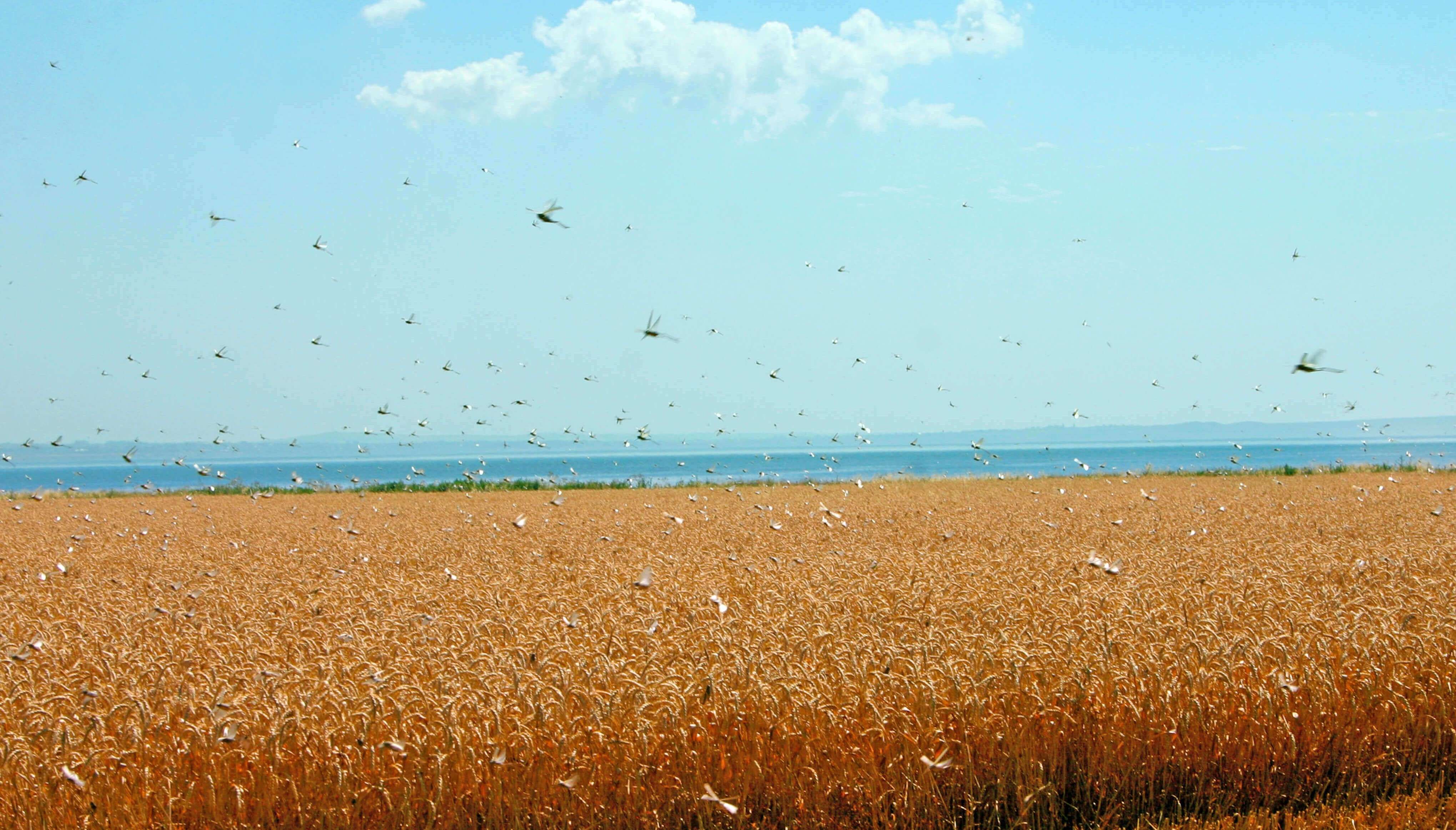
Locust swarms are known to feed on crops, trees, and other types of plants. This feeding can destroy crops planted, causing famine and deprivation in societies that solely rely on these crops for survival. In recent times, swarms of locusts have invaded several areas in India, especially Rajasthan. With nearly 90,000 Hectares of land affected across 20 districts, these growing swarms are threatening to amplify into an agrarian disaster.
Most nations battling locust swarms rely significantly on organophosphate chemicals. These are utilized in little concentrated lots by vehicle-mounted and aerial sprayers. Rajasthan has stationed drones to carry out the spraying efficiently. Drones can diffuse pesticides on approximately 2.5-acres in merely 15 minutes. Using drones to combat the locust swarms is an immediate, secure, and practical approach.
FINAL THOUGHTS
As mentioned before, agricultural drone technology is undoubtedly the future of the Indian agrarian community. It can transform traditional farming methods in uncountable ways. Even though this technology is more complex to be familiar with, it will yield its results in no time once learned.
Farmers must understand the entire process. Determination of goals, creating an equilibrium in the drone and software utilized, and being familiar with the principles of using such technology will stand as a challenge. The farmers will inevitably need comprehensive training or partnerships with third-party experts in the drone industry for the acquisition of reliable data. Drones have changed the course of obtaining data in almost every type of industry, and will only deem to become bigger and better in the coming years.
Just want to say your article is as astonishing. The clarity in your post is just nice and i can assume you are an expert on this subject. Fine with your permission allow me to grab your feed to keep up to date with forthcoming post. Thanks a million and please continue the gratifying work.
I am glad to be one of the visitants on this outstanding internet site (:, regards for posting .
Everything is very open with a clear clarification of the
issues. It was truly informative. Your website is extremely helpful.
Thanks for sharing!