
INTRODUCTION
With immense development and contemporary technological progressions, the application of Unmanned Aerial Vehicles (UAVs) proceeds to remodel diverse industries and fields. The introduction of smart Drone-Powered solutions and the implementation of scientific instruments, enterprises have given a distinct denomination to traditional surveying and safety inspections of assets. Construction site monitoring and planning is a crucial sector that employs UAVs for enhanced performance, velocity, and precision of information. Exhibiting opportunities for extensive uses of drones, they are well-established in the numerous construction project steps such as pre-planning, comprehensive surveying, 3D mapping, construction process monitoring, quality monitoring, safety inspections, marketing, etc.
In the world of the ever-growing construction site industry, planners and architects often employ drones as a real-time tool to observe their progress and if it corresponds with their vision and imagination. The information acquired also encourages developers and construction site businesses to track their inventory. This blog vividly explains how drones and Unmanned Aerial Vehicles (UAVs) have molded the construction industry with intelligent construction site monitoring and reporting systems supported by real-time data.
UAV GAME-CHANGER FOR CONSTRUCTION INDUSTRY
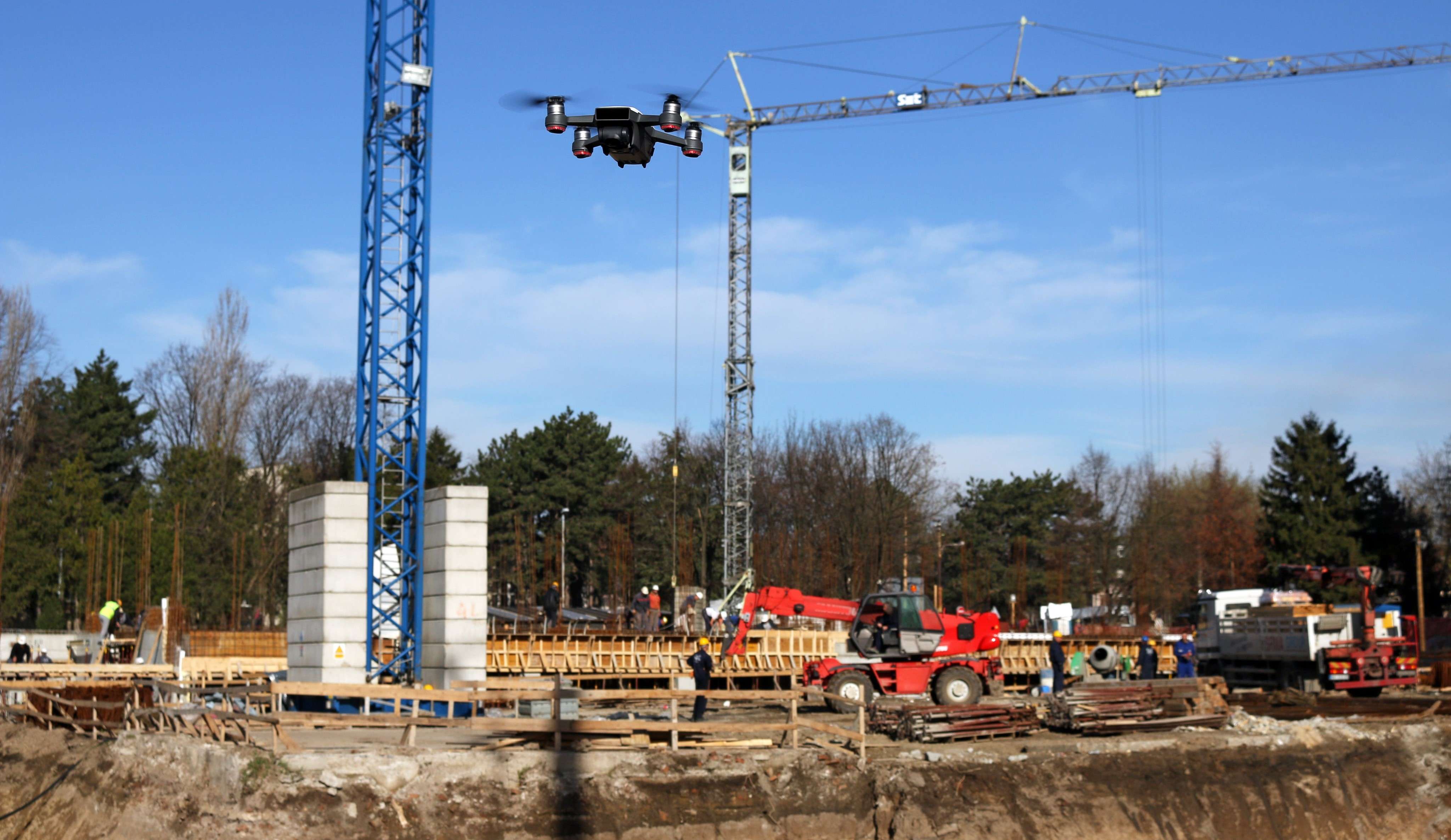
The Drone market has been booming with increased sales and revenue in the past decade. Their advantages, especially in the construction industry, have transformed the sector towards enhanced efficiency and accuracy. Construction project managers often map the job-site every week, employing UAVs or drones. Routine surveying is fundamental for tracing development, safety inspections, and real-time quality monitoring. Drones allow users to get a bird-eye-view on the entire project and reveal concerns that would be impossible at ground level inspections. Geotagging capabilities of drone maps enable the capture of necessary area measurement and transform it into an estimated stockpile volume for quick, reliable decision-making.
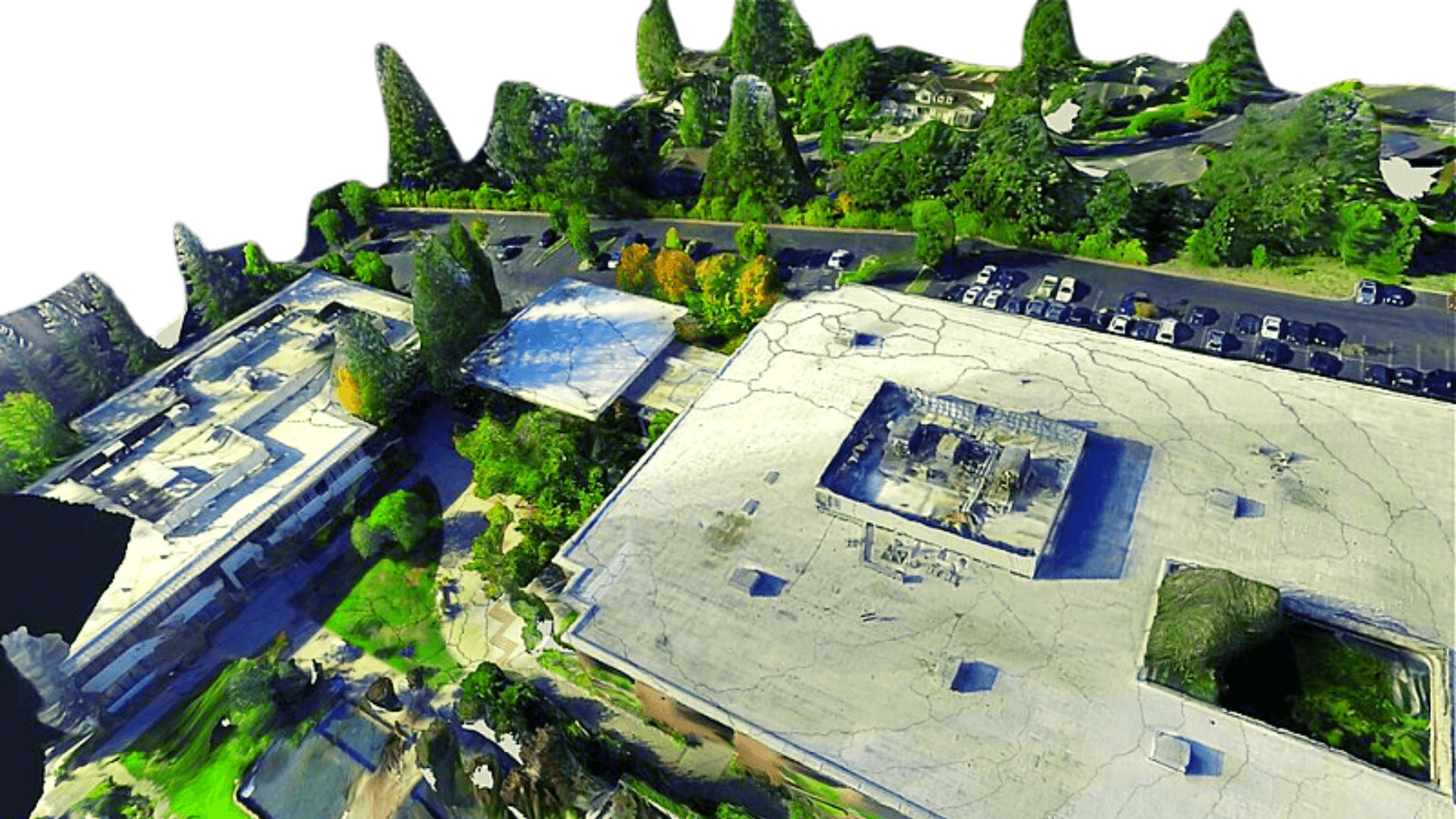
Firstly, the digitization of job sites has given rise to a broad perspective of the entire construction project in just a single snapshot required by developers. Secondly, the representation of land as an orthomosaic map, which is a sequence of individual photos linked together via software, contributes an in-depth analysis as they can estimate true distances. Thirdly, the data can also be mirrored as 3D models via multiple 3D points of the site to give life to the constructor’s perspective of their project. A complete 360 view of the job site allows clients, stakeholders, and even the workers to gain insight about the project, but safely. That’s not it! Unmanned Aerial Vehicles (UAVs) can also generate Computer-Aided Design (CAD) overlays and see whether their activity has diverged from the design plans.
With a plethora of drone models available in the market, they all produce high-resolution images tailored accordingly for topographic support, lens distortion, and camera tilt. Drone technology has allowed the construction industry to display their projects in ways they would never have envisioned. The team gets the bigger-picture and moves towards efficiency, productivity, and informed decision-making.
BENEFITS OF UAV IN CONSTRUCTION INDUSTRY
- Monitoring – Construction site and progress monitoring is a crucial job for contractors that are performed by high-resolution drones. With weekly and monthly site visits, excellent quality photography and videography can be produced on-site at flexible times. Contractors and construction firms can monitor their subcontractors, materials, equipment, and stockpile volumes as well.
- Surveying – GIS is evolving adjacent to drone technology. Obtaining drone data quickly is now an achievable task and can be performed in almost moments when compared to traditional techniques. The skilled pilots arrive on-site to collect all aerial data required for photogrammetry, without hindering any on-going constructions or activities

- Progress Reporting – Staying informed with all stakeholders involved in the construction process is vital. Progress reports are a great way to keep track of activities, keeping investors involved, saving costs through staying on track always. Drones capture accurate and timely information that can be transformed into reports for future use as well. The data can be represented as 3D models of the site, orthomosaic maps, and other photogrammetry data to check site progress.
- Inventory Management – Keeping track of all the material, equipment, and inventory on-site is a challenging task. Using photogrammetry, captured drone data can help you keep an eye on the assets at your convenience instead of exhausting hours operating at the construction site.
- Volumetric Estimation – Through specific volumetric measurements, the construction firms can keep an eye on the size of the material entering and leaving the site. Stockpile measurement results in preserved time and funds for the users.
- Structural Integrity Maintenance – Regular quality checks of the site; its elevation is a practice that should be carried out without a doubt. Identifying and inspecting any structure vulnerability aids eliminate possible future problems regarding safety and save high costs in the event of any lawsuit.
You may also like
Importance of Drone Technology in Indian Agriculture, Farming
Automate Your Solar Panel Inspection Using Ai-powered Drones
Drones for Wind Turbine Inspection & Surface Damage Detection
IMPORTANT APPLICATIONS OF DRONES AND UAVS IN CONSTRUCTION MONITORING
One of the significant disadvantages of traditional monitoring of construction projects is that a stern execution process must be carried that leaves less or no potential for last-minute modifications. Since there is a considerable risk of human errors, the accuracy of real-time data is often compromised. In contrast, employing UAVs or drones, a reliable monitoring and surveying system can be established to obtain accurate, timely, and trustworthy data. Unmanned Aerial Vehicles (UAVs) are often furnished with high-quality sensors for versatile purposes, high-resolution cameras, and various high-level components and software. After data collection, the information is then processed and analyzed through advanced software for enhanced operations, preparations, and improvements. Some essential applications of Drones and UAVs in construction monitoring are as follows:
- 3D Mapping – Through accurate Aerial monitoring and inspections, Drones provide data for 3D creations and orthomosaic maps of the construction sites. Topography enables seizing specific site-maps, including contours and terrain, to be systematically captured, updated, and collected as online maps for convenient inspection of objects. 3D Mapping gives rise to greater control over projects, updating stakeholders frequently, and easy detection of illegal constructions by the government, in a fraction of the time and expense of traditional practices.
- Aerial Photography & 3D Modelling – Aerial photography and videography are often used to provide clients with compelling and essential visuals of the construction and how it will be in the future. 3D models enable detailed representations of the constructor’s vision and can conveniently be viewed online. Architects and interior designers rely on these models for future planning and landscaping.
- Construction Progress Monitoring – As the project continues to embody the constructor’s vision, it is crucial to develop regular flight routes over and around the construction site for real-time progress monitoring. This data assists developers, stakeholders, and all others engaging in the process of the construction. Monthly site visits are encouraged to keep an eye at the advancements to fulfill significant milestones for the company.
- Volumetric Measurement – Aerial Photogrammetry warrants seizing extensive areas (2D and 3D) with almost 99% accuracy! The volumetric measurements are not just highly accurate, but also quick to capture, cost-efficient, and very convenient as they do not disrupt any day-to-day operations on-site.

HOW DRONE SERVICES WORK
- Job-site Documentation – The Construction industry is a booming industry for the utilization of Drones. However, it takes skill and experience to be able to carry out the tasks of procuring necessary detailed information via this technology regularly. With Progress Photos, you can automate visible construction site documentation during the growth of the project! Through phones, laptops, or tablets, you can schedule automated drone pictures and also produce acknowledged progress reports for clients and stakeholders in just moments.
- Consistent Progress Reporting – Consistency in construction monitoring plays a vital role to ensure quality and productivity. Regular monitoring, say weekly, however, is a challenging task. There are several questions asked. Are these Aerial photographs taken from the same location as the earlier survey? Is it taken from the same altitude and angle? To make things easier, with the assistance of photo missions, it is now possible to duplicate drone flights every week for retained consistency. Once you have established an original flight plan, every other week, the same procedure is duplicated to collect data.
- Share the data acquired – The next step is to immediately produce progress reports that are to be shared with necessary clients and stakeholders backing the project. Once the progress monitoring information is captured, the process to yield a progress report takes minutes to process. The information may be represented as 3D models, Orthomosaic maps, and other Topographical outputs for a clear understanding. Communication and transparency are both gravely established through this process.
- Store all Drone data in one place – It is essential that after obtaining crucial job-site data, authority and responsibility for its safety is also established. It is suitable to store all data such as Aerial images, maps, 3D models, etc. in a single place that is available anywhere and supported by several devices. This process initiates effective team collaboration and organization.
I prefer high-quality content, which I discovered in your article.
The information you’ve provided is useful and important to
us. Continue to post articles like these. Thank you very much.
Drone Video Company
Great job on this post! The content is extremely educational and well-researched, providing valuable
insights into the subject at hand. The style of writing is captivating and moves seamlessly, making it an delightful
read. I appreciate the effort put into conveying complex ideas
in a concise and manner. This write-up has undoubtedly expanded my
knowledge on the topic. Well done to the writer for delivering such a high-quality work!|I’m thoroughly impressed with the excellence of this post.
The writer has expertly presented a fair view on the subject, providing both
sides of the argument in a just and objective manner.
The research and facts cited throughout the piece add
reliability to the claims made. I admire the clearness of the writing, which made it simple to understand and understand
complicated notions. This post is a precious tool for anyone seeking a comprehensive understanding of the
subject matter.|This article is a refreshing change!
The author’s unique perspective and creative approach make it set itself apart
from the rest. I found myself immersed in the fascinating storytelling and the smooth flow of ideas.
The author’s passion for the topic shines through every word, making the exploration truly
delightful. I praise the effort put into fashioning such
an unique piece. Well done!|This is an remarkable piece of content!
The author’s thorough knowledge of the topic is apparent throughout the write-up.
The precise and concise explanations, coupled with supporting illustrations, make
complicated ideas easy to comprehend. I admire the extensive research that went into this piece, as it provides a solid groundwork for
the claims presented. The author’s style of writing is compelling and keeps the viewer
captivated until the end. I was amazed by the smooth transition between thoughts and the rational structure of the piece.
The author’s ability to present nuanced points and provide
mind-boggling insights is praiseworthy. It’s clear that a great deal
of energy and proficiency went into creating this outstanding article.
I highly recommend it to anyone looking for a well-crafted and
enlightening piece.|I must say, this article went beyond my anticipations!
The thoroughness of examination and the distinctive perspective offered really
differentiates it apart. The author’s mastery of the
subject shines through, making complex concepts effortlessly understandable.
The writing style is engaging and holds the
reader’s interest from the very beginning. I found myself
absorbed in the content, eagerly absorbing every word. This is a commendable piece of work
that deserves appreciation. Well done!
This blog post is a welcome departure! The author’s distinctive point of view and innovative approach make it set itself apart from the rest.
I found myself immersed in the captivating storytelling and the smooth
flow of ideas. The author’s enthusiasm for the topic shines through
every word, making the exploration truly delightful.
I praise the effort put into crafting such an unique
piece. Well done!
Good blog you’ve got here.. It’s hard to find
high quality writing like yours nowadays. I truly appreciate individuals like you!
Take care!!